
Elbert County Planning Commission recommends denial of Shepherd Solar project
The 5-2 recommendation followed referral reviews that raised questions about roads, fire safety, wildlife, drainage, sanitation and stormwater. The county commissioners will make the final decision.
Published at
The Elbert County Planning Commission voted 5-2 on Sept. 1 to recommend denying the roughly 1,990-acre Shepherd Solar project, citing compatibility, buffering and screening, and the health, safety and welfare of county residents.
The recommendation is not final. The county staff report scheduled the project for a Sept. 9 hearing before the Board of County Commissioners. The supplied record does not show whether that hearing has occurred or whether the board approved, denied or continued the project.
Shepherd Solar LLC, a BayWa r.e. subsidiary, is seeking approval for a 199-megawatt photovoltaic facility paired with a 100-megawatt battery-storage system. The project would cover about 1,990 acres across three Agriculture-zoned parcels near Matheson and requires a Special Use by Review permit and a concurrent Major 1041 permit, according to the project application.
The commission cited three approval criteria: compatibility with the surrounding area and neighborhood; adequate landscaping, buffering and screening; and protection of residents’ health, safety and welfare. The staff report says 10 residents spoke at the hearing, all opposing the project, with concerns including traffic, natural hazards, the area’s character, soil, health and wildlife.
Referral reviews raised infrastructure and environmental questions
The county’s first referral period ran from May 29 through June 25. The referral packet documents agency comments and preliminary technical requests, not final county conditions or a final decision.
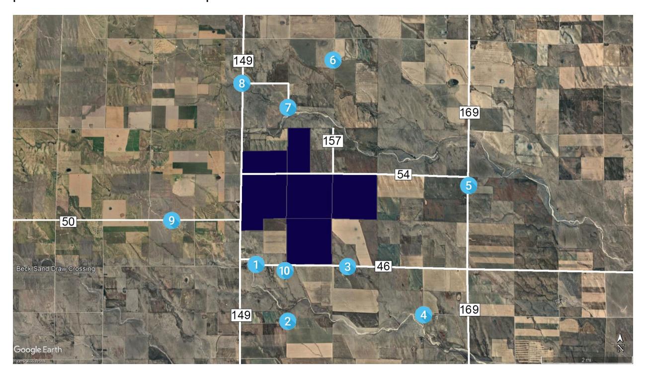
Elbert County Public Works said about 3.5 miles of County Road 54, between County Roads 149 and 169, would need to be upgraded to a gravel Local Road Type I. It also requested improvements and maintenance for haul routes and county-standard access to project facilities. Those details were to be addressed in a future Road Use Agreement.
A traffic review called for coordination with the county and the Colorado Department of Transportation and said additional turn-lane or traffic-impact analysis, access permits and road-condition surveys could be required. The Big Sandy Fire Protection District requested 20-foot-wide all-weather access roads and additional battery-safety and emergency-response materials, including a site-specific mitigation analysis and an Emergency Response Plan.
Other agency comments addressed wildlife, drainage and water. Colorado Parks and Wildlife identified nearby aquatic conservation waters and potential habitat for pronghorn, mountain plover, burrowing owl and swift fox, and recommended surveys, seasonal protections, wildlife-compatible fencing and movement corridors. The referral packet also identified FEMA Zone A floodplain on the broader property and modeled potential scour in some panel areas. Reviewers requested additional drainage, culvert and erosion-protection calculations.
County public-health officials requested more information about construction-worker facilities, portable toilets and commercial septic requirements. The application says the project would use trucked water and private septic infrastructure rather than county water or sewer service.
Road commitments and technical reviews remained unresolved
Shepherd submitted revised materials July 16. A second referral review ran from July 22 through Aug. 6, and an Aug. 7 status letter deemed the application sufficient for continued processing. That determination did not establish final permits, completed road work, an executed Road Use Agreement or final county conditions.
In its response, the applicant committed to upgrading about 3.5 miles of County Road 54, with timing and specifications to be documented in a future Road Use Agreement. The available records do not identify the cost, funding schedule or final payment arrangement, and do not show that the agreement was executed, financial security was posted or work had begun. The records therefore establish the applicant’s proposed commitments but not who would ultimately pay for the upgrades.
Traffic review also remained incomplete before the commission’s recommendation. The second-referral materials said the application lacked a Level 2 turn-lane evaluation and Level 3 traffic-impact study, while final culvert and riprap designs remained subject to later review.
The application estimates construction would take 18 to 24 months, with grazing or crop farming continuing on portions of the property. Project-capacity figures are not fully consistent: the application and staff materials generally identify 199 megawatts, while preliminary civil plans identify a 309-megawatt-direct-current/231-megawatt-alternating-current array. The supplied records do not explain the difference.