
Elizabeth commission recommends up to 179 homes at Gold Creek Commons
The Planning Commission unanimously recommended an amendment for the development north of Highway 86; the Board of Trustees is scheduled to consider it Aug. 25.
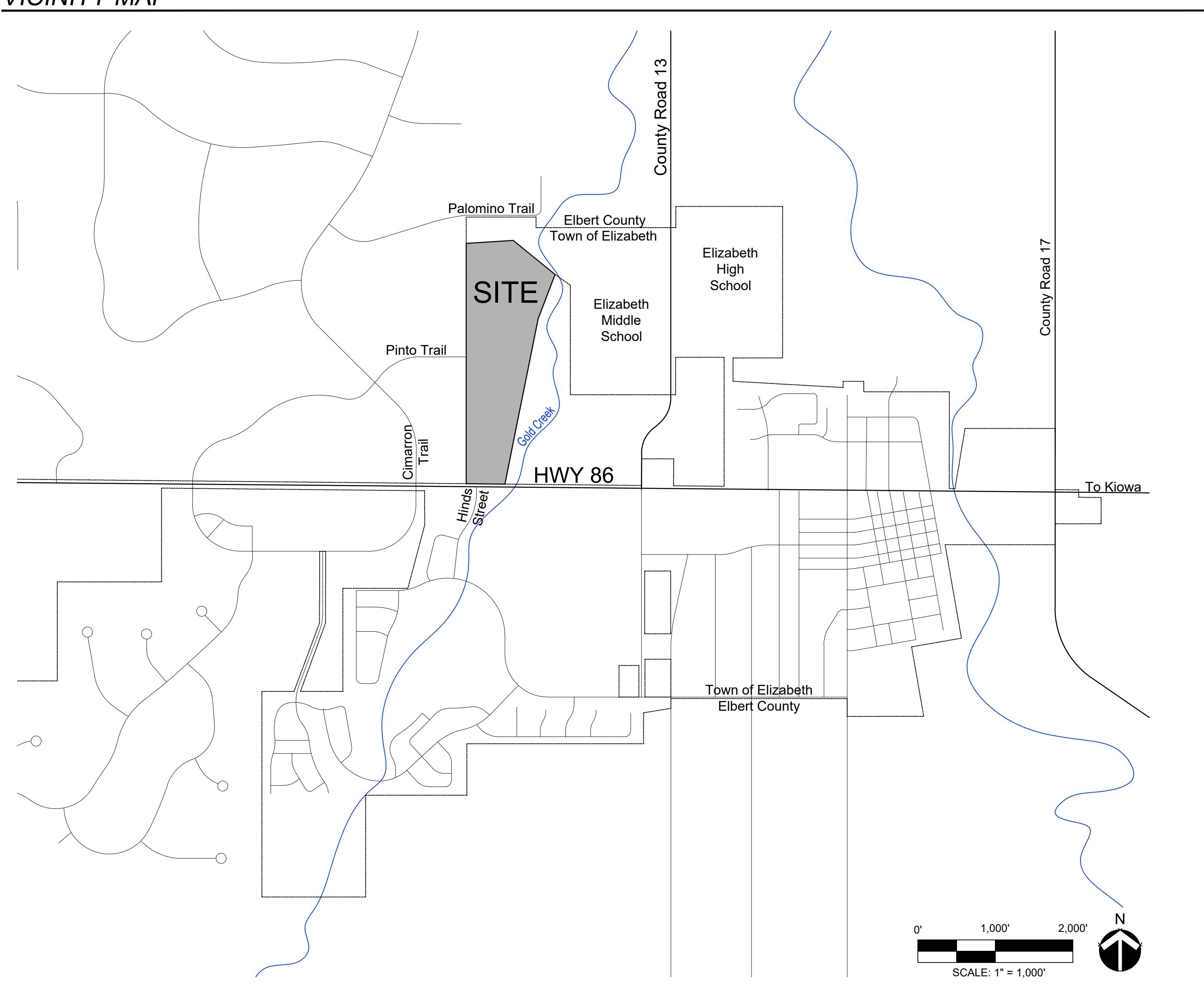
The Elizabeth Planning Commission unanimously recommended Aug. 18 that the Board of Trustees approve an amendment allowing up to 179 homes at Gold Creek Commons. The board’s final vote remained pending as of Aug. 22.
Ordinance 26-13 would revise the approximately 56.4-acre development planned north of Highway 86. The proposal would designate 36.1 acres for residential use, including no more than 10 duplex units; reduce commercial acreage from about 25.7 acres to 3.3 acres; and increase open space to about 17 acres, or 30.1% of the site.
The recommendation followed a quasi-judicial public hearing. All commissioners voted in favor, with no opposition recorded, according to the Aug. 18 meeting video. The recommendation does not authorize construction or constitute final approval.
Residents generally supported reducing the commercial component, expanding open space and adding buffers. They also raised concerns about flooding and drainage, water use, traffic on Palomino Trail and nearby county roads, emergency access and the lack of a direct connection to County Road 13. One resident opposed the amendment, citing density, traffic, floodplain development and repeated changes to subdivision approvals.
The applicant said the revised plan would reduce traffic by about 36% compared with the currently approved plan. Separately, the staff report’s traffic comparison estimates 4,476 weekday vehicle trips for the proposed first-amendment scenario: 179 single-family detached homes and a 14-pump convenience store and gas station. The January 2026 Traffic Impact Study estimated 6,808 weekday trips for a different mix: 48 detached homes, 86 attached homes, the same gas station, 50,000 square feet of retail and 30,000 square feet of office. The modeled difference is 2,332 trips, or about 34%; it is not a measurement of traffic after construction.
The applicant also said no structures are planned within the FEMA-designated floodplain and that drainage improvements and retention ponds would reduce downstream flooding risks. Those are representations about the proposal; drainage design remains subject to later engineering review.
The plan calls for a Highway 86 access connection that the applicant expects to be a full four-way signalized intersection. The developer would be responsible for a deceleration lane, a left-turn lane and half the signal costs shared with the commercial property owner across the highway. Final access design would go through the Colorado Department of Transportation’s access-permit and intersection process at the plat stage. Palomino Trail remains a potential emergency-access connection while town, county and fire-marshal requirements are determined.
Board action and next steps
The Board of Trustees’ Aug. 25 agenda packet lists a public hearing and discussion with possible action on Ordinance 26-13. As of Aug. 22, the packet and ordinance attachment documented no completed vote or final board-imposed conditions.
The proposed development guide includes a 25-foot western buffer next to rural residential and equestrian properties, fire-flow and hydrant requirements, water-storage standards and wildfire-resiliency requirements. These are not final conditions unless the board adopts them.
Even if the board approves the amendment, the developer would still need separate Sketch Plan, Preliminary Plan and Final Plat approvals, each involving additional technical review and public hearings. The project is planned for Town water and sewer, with the applicant responsible for extending utility lines and paying applicable fees before building permits are issued. Staff projected about $643,009 in annual Town tax revenue, a net annual public benefit of about $303,109 after estimated service costs and roughly $2.96 million in one-time Town fees. Those figures are projections, not guaranteed revenue.